
there stands the Taebaeksanmaek Mountain Range. The Nakdonggang flows from north to south passing through the central part of the province.The Sobaeksanmaek Mountain Range stands on the west side of the province borders on Jeollanam-do. Gyeongsangnam-do is topographically flat and low land.
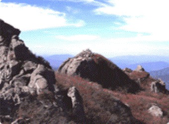
The elevation of the land in the province is apportioned as follows: 37% is lower than 100m, 49% is between 100~500m high, 12% is between 500~1,000m high and 2% is 1,000m or over. In the eastern part of the province, there are many valleys as well as mountains about 1,000m in height: Cheonhwangsan(1,189m), Sinbulsan(1,209m), Wonhyosan(922m), and Cheonseongsan(840m). These mountains and valleys including Hyeongsangang rice belt between Gyeongju and Ulsan, contribute to the cultural activities of the province greatly.
From the central lower part of peninsular, the Nakdonggang flows into the province, joins its tributaries, and then finds its way to the South Sea along the southern parts of the province. It makes a delta plain at the downstream of Gimhae area. The slope of the river (the gradient in the downstream: 1:10,000) is so slight that it was easily flooded in the past. With the construction of several dams including Namgang Dam in 1969 and Andong Dam in 1976, this problem has been alleviated considerably.
are located on the alluvial plains and valleys eroded by the rivers. The western mountain area is the steepest region of the province, which includes Jirisan(1,915m), Deokyusan(1,614m), and Baekunsan(1,279m). The area near Jirisan is the steepest. Many basins in the mountains form main production areas of the region. On the other hand, shaped ria coast, the southern coast has been formed an archipelago which has a variety of islands and bays. Especially the area near Hallyeosudo is designated as a national marine park along with the battlegrounds of Chungmugong. The province is located in low latitude, the southeastern part of Korean peninsula. The climate of the province is greatly affected by the sea because the southern part comes in contact with sea on the other hand, the north west side adjoining, high mountains block the cold northeast wind, shows the mildest climate in the nation.
The average temperature in January is about 2.5℃ and about 25.3℃ in August. The precipitation is about 1,500mm but it varies considerably by area.
The core business of each base and zone includes the development of a resort complex in the Jinju vicinity, a golf course and a plateau tour ranch in Changnyeong, Dagok Resort in Hamyang and Jangmok Comprehensive Resort Complex in Geoje as a national marine park along with the battlegrounds of Chungmugong.
The province is located in low latitude, the southeastern part of Korean peninsula. The climate of the province is greatly affected by the sea because the south part comes in contact with sea. On the other hand, the north west side adjoining, high mountains block the cold northeast wind, thus the province shows the mildest climate in the nation. The average temperature in January is about 2.5℃ and about 25.3℃ in August. The precipitation is about 1,500mm but it varies considerably by area.
